
Five lakes, four waymarked walks and a wartime airfield, all inside the boundary. Tap a marker to see what you are looking at.
Everything on this map is a walk, not a drive. The lakes sit within a few minutes of the lodges, the waymarked trails loop back to where they started, and the public footpaths and bridleways carry on out to Nassington, Yarwell, Apethorpe and Wansford if you want a longer day.
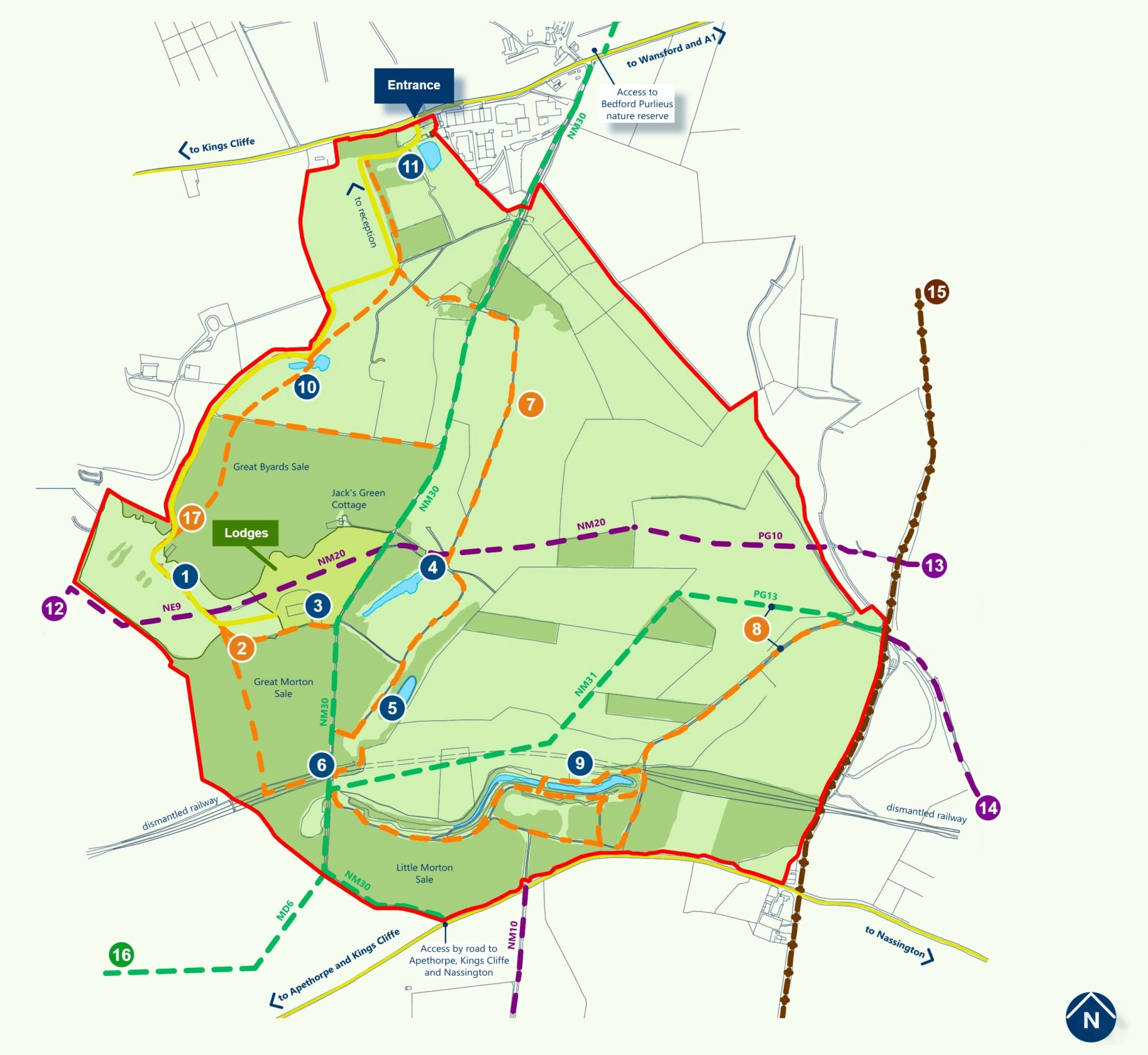
Not everything has a number on the map. These are the other places worth walking to.
Station 367, and the fighter groups who flew from this ground between 1941 and 1959.
Little doors, tiny houses and wind chimes hidden along the Montgomery Walk.
Plus a football pitch and outdoor games, a short walk from the lodges.
Five in total, two of them carp water and open to anglers.
Waymarked walks straight from your veranda.
Timber exercise stations set along the path through the trees.
A covered timber shelter with picnic benches, out on the green.
The printed version has the full local area on it, including the routes out to Yarwell, Nassington and Bedford Purlieus nature reserve.
From above
The same ground seen from the air, with the buildings and the things to do on it marked. The numbers on this photograph are its own set — they are not the numbered points on the walking map above.
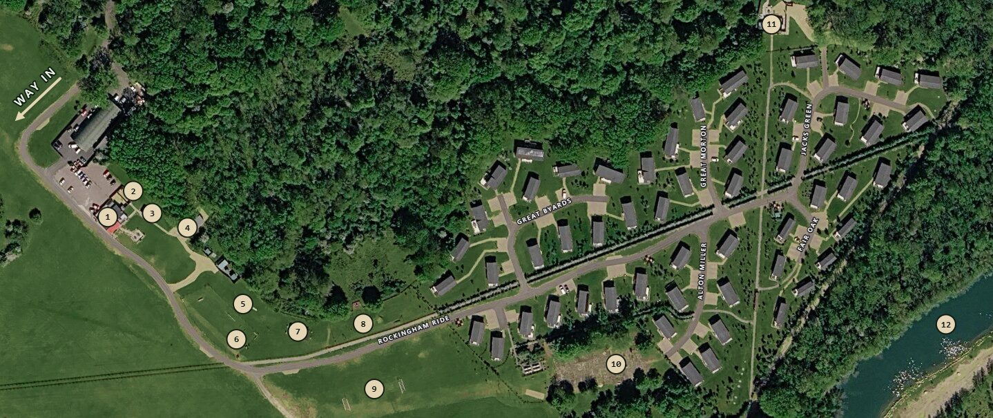
Tap the map to enlarge →